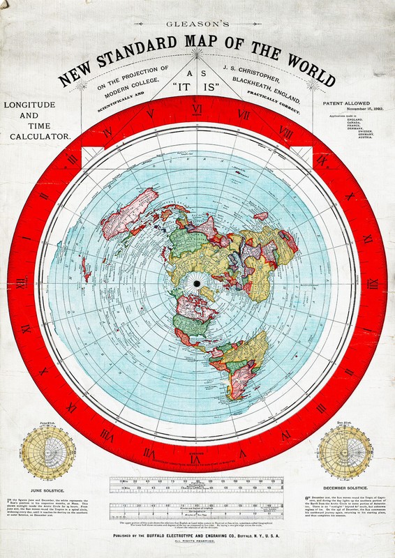

1892 Flat Earth Map - Alexander Gleason's New Standard Map the World Globe Model
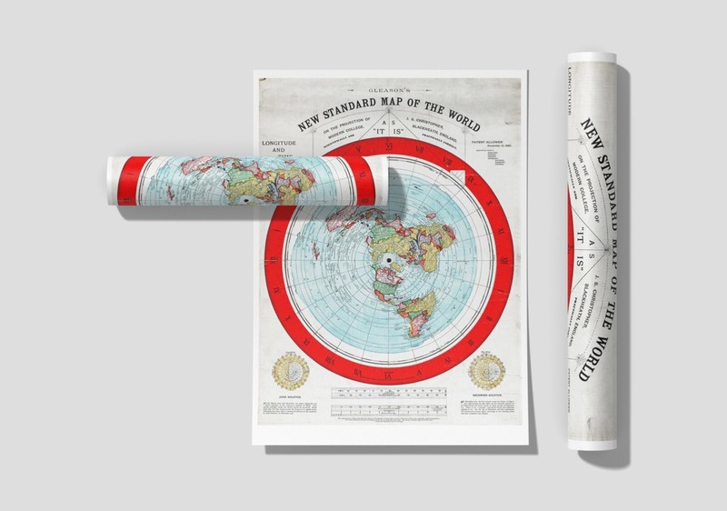
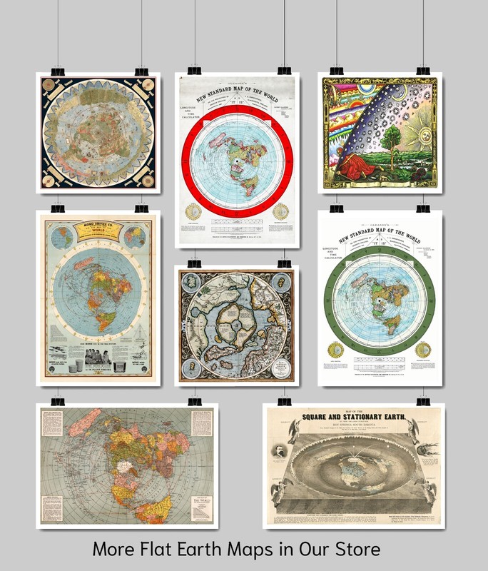
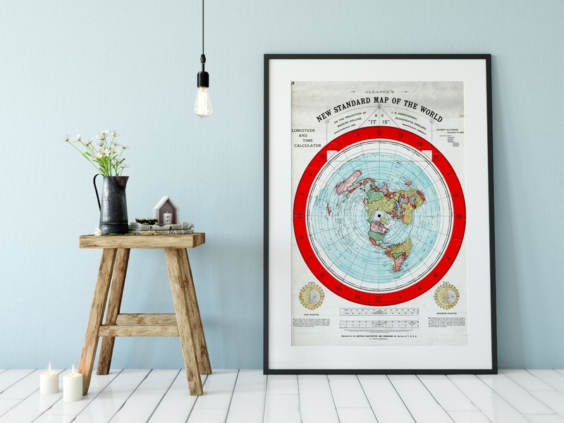
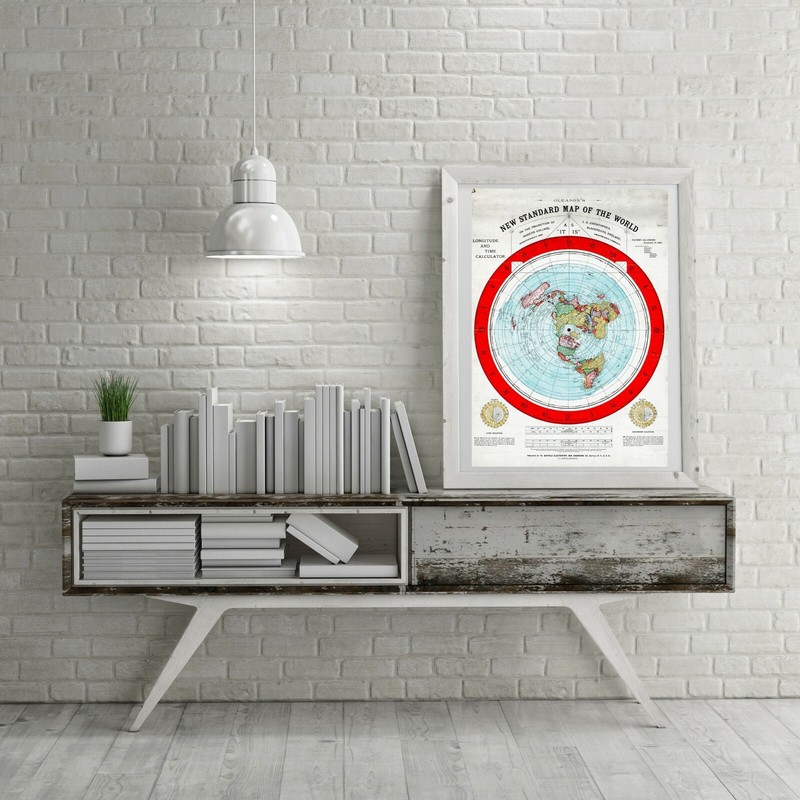
We have more Flat Earth Maps, you can find them in Our Store We have more World Maps, you can find them in Our Store REMEMBER, the smaller the map size the harder it is to read the text. All Our Maps and Posters Are Made in the USA Title: Gleason's new standard map of the world on the projection of J. S. Christopher, Modern College, Blackheath, England; scientifically and practically correct ; as "it is." Notes: Map of the globe stretched and flattened into a circular plane. Includes longitude and time calculator and diagrams showing June and December solstices. Border shows "sun-time in minutes." This map comes with a white border around the image --------------------------- -How are the prints shipped? They are rolled and placed into a rigid tube or box. -Is this available in a larger/smaller size. Yes. For smaller or larger sizes, email us.
Specifications
| Return Shipping Will Be Paid By | Seller |
| All Returns Accepted | Returns Accepted |
| Item Must Be Returned Within | 30 Days |
| Artist | Alexander Gleason |
| Origin | United States |
| Date Of Creation | 1800-1899 |
| MPN | Does Not Apply |
| Item Length | 3 variations |
| Department | Adults |
| Unit Type | Unit |
| Item Height | 3 variations |
| Style | Vintage/Retro |
| Features | Unframed |
| Production Style | Printed |
| Room | Home Office/Study |
| Item Width | 3 variations |
| Character | Flat Earth Map |
| Color | Multicolor |
| Material | Paper |
| Orientation | Vertical |
| Subject | Flat Earth Maps |
| Brand | Unbranded |
| Type | Poster |
| Era | Victorian (1837-1900) |
| Theme | Maps |
| Original/Reproduction | Reproduction |
| Country/Region Of Manufacture | United States |
| Character Family | Flat Earth Maps |
We have more Flat Earth Maps, you can find them in Our Store We have more World Maps, you can find them in Our Store REMEMBER, the smaller the map size the harder it is to read the text. All Our Maps and Posters Are Made in the USA Title: Gleason’s new standard map of the world on the projection of J. S. Christopher, Modern College, Blackheath, England; scientifically and practically correct ; as “it is.” Notes: Map of the globe stretched and flattened into a circular plane. Includes longitude and time calculator and diagrams showing June and December solstices. Border shows “sun-time in minutes.” This map comes with a white border around the image ————————— -How are the prints shipped? They are rolled and placed into a rigid tube or box. -Is this available in a larger/smaller size. Yes. For smaller or larger sizes, email us.